loading map - please wait...
Find us
If you are visiting from outside the area our postal address is:
St Peter & St Paul’s Church
The Street,
Upper Stoke,
Kent,
ME3 9RT.
Priest in charge Reverend Christine Allen can be contacted on 01634 853172 or email Christine at: revchrisallen74@gmail.com
Church Warden Ian Bett can be contacted on 01634 270026 or email Ian at: info@stpeterstpaulupperstoke.com
Walking Directions
If you would like to walk from Lower Stoke to the Church like the pupils from Stoke County Primary school we are 1 minutes-walk away from a public Footpath.
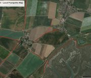
From Lower Stoke it would take approximately 30-40 minutes depending on your pace. The map below shows all local Stoke footpaths in red. For specific information we advise the use of Ordinance Survey Maps which will give details of landmarks and terrain and where these connect with Stoke villages etc.
Upper Stoke walking map – click to enlarge.


